
As Craig and Courtney mentioned, the three of us were introduced to the ArcGIS software on Wednesday afternoon. After learning a little bit about the software and its possible applications to our project, we settled on three general areas that our project might cover, split up into two maps.
As has already been mentioned, one of the maps would be of Houston and possibly have two layers. One of the layers would encompass locations important to Dowling’s life in Houston and the other would cover evidence of his legacy that is still present in Houston today such as his statue in Hermann Park and Dowling Street. From what we learned, the software could easily be used to generate a layered map like this.
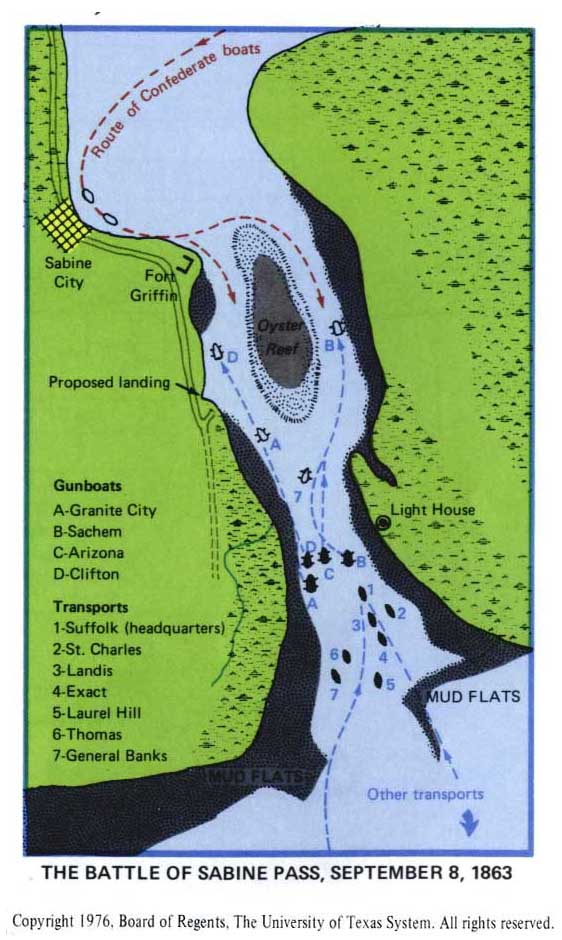
The second map would be of the Sabine Pass area and help illustrate the battle. Like Courtney, I also tried to do a little research to get a better understanding of the geographical layout of Sabine Pass now and when the battle took place. I wasn’t able to find a significant amount of useful information, so I think our group will definitely have to put a little more time into researching that so we can settle on a concrete plan for what our map of the area might include.
I believe our group has a good start, but we definitely need to finalize some details for our project. I think the archive of articles that our class has already digitized may come in handy for assisting in creating a list of points relevant to Dowling’s life and legacy. I will also do some more research at Fondren into Dowling’s biographical information before our group meets again to try and determine some more locations that might be relevant to Dowling’s life.